Tawas Point is a sand hook. It curls out of the Lake Huron shoreline for about a mile and a half and wraps back on itself, so it ends up with Lake Huron on one flank and Tawas Bay on the other — and shallow sand around most of it. That geometry is the whole spot. Where most Great Lakes beaches give you one shoreline facing one way, and therefore one wind that works, Tawas gives you a shore that faces eight of the twelve points of the compass within three miles of walking. The flat water is on the bay side and the prevailing wind is the one that makes it flat. The chop, when you want it, is on the Huron side. Almost whatever the wind is doing, some part of this point is side-onshore over waist-deep sand.
Seasonal Conditions
The Point Buys You Days
Most spot guides chart how windy a place is. That number flatters everywhere on the Great Lakes in November and disappoints everywhere in July, and it does not tell you whether you can ride. So the chart below counts something narrower: the share of each month's hours carrying a 15+ knot wind from a direction one side of the point can actually use — northeast round through west. Winds from the northwest and north are left out of it, because although the bay shore technically faces them, that is the coldest corner of the compass here and nobody has told us they ride it.
It adds up to about 238 days a year. There are roughly 271 days a year with a 15+ knot wind of any kind on this stretch of coast, so having two shorelines back to back converts 88% of the windy days into rideable ones. That is the number the geography is worth.
The two sides are seasonally complementary, which is the part you cannot see from a single forecast. The bay's flat-water window — south through west — peaks in November at 28% of hours and collapses in May to 5%, the deadest month of its year. The Lake Huron side's window runs the other way: it holds up through the spring at 13% of May's hours, and 55% of those are northeast. When the bay goes quiet in late spring, the wind that is still blowing is the one the Huron beach wants.
October, November and December are the season, and April is the honest second window — it carries as much usable wind as January does without the ice. Tawas Bay is shallow and freezes in a normal winter, which is what takes January through March away; they are as strong as October on paper and mostly unusable in practice. And note what July is and is not: 9% is the low point of the year, but it still works out to around sixteen days in the month with a rideable direction over 15 knots. The quiet season here is quiet, not empty.
Petal length = % of 15+ kt hours • NDBC SBLM4, Saginaw Bay Light #1 • 7-yr avg 2019–2025
The prevailing wind is the flat-water wind. Southwest and west are the two most common strong directions on this coast — 41% of all windy hours between them — and both leave the bay side of the point sheltered and smooth. That is an unusually lucky piece of geography, and it is why the kite school here teaches on south, southwest and west. Most flat-water spots ask you to wait for an unusual wind. This one does not.
Reading the Point
Which Side, and Why
The useful skill at Tawas is not reading the forecast, it is reading the map. Each stretch of this shoreline faces a different way, and a wind that is unusable on one side of a sandbar is side-onshore over shallow sand a ten-minute walk away. These are the shore angles, measured off the mapped shoreline rather than eyeballed:
The state park day-use beach. A mile of sand facing about 138°, so it is onshore or side-onshore from NE round to SW and firmly offshore on anything from the west or northwest. Open lake in front of it, which means real chop when it blows — this is the side to pick when you want to hit something, and the side that keeps working through late spring when the bay has gone quiet.
The sheltered flank, facing about 300°, onshore from SW through W to NW. Two or three miles of shallow bay is all the fetch there is, so the prevailing southwesterly arrives here having had nothing to build with. This is the flat water the spot is known for — but the park's beach on this side is the campground swimming beach, so read the launches section before you plan to rig on it.
East Tawas town beach, facing about 172°, onshore from E through S to SW. The other end of the same flat water, and the side of the bay you are on if you are walking from town. A west or northwest wind is offshore here even though it is onshore across the bay at the point — the two shores face each other, so they invert.
Tawas City park beach, facing about 121°, onshore from NE through E to S. The corner of the bay furthest from the point, and the one that catches an easterly while the Huron side of the point is getting the same wind with the whole lake behind it. Shallow and quiet.
The rule that saves the drive: at Tawas you do not ask whether it is on, you ask which side is on. A wind that is offshore and unrideable at the town beach is onshore and flat across the bay at the point, and a wind that is dead offshore on the bay is side-onshore on the Lake Huron beach a few hundred yards away. Three miles of shoreline here face eight of the twelve compass bands. The only genuinely awkward corner is the neck of the point itself, where the land runs out to the southwest.
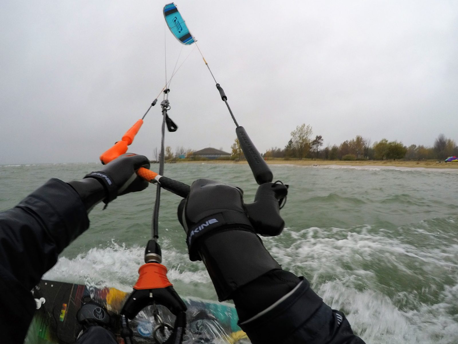
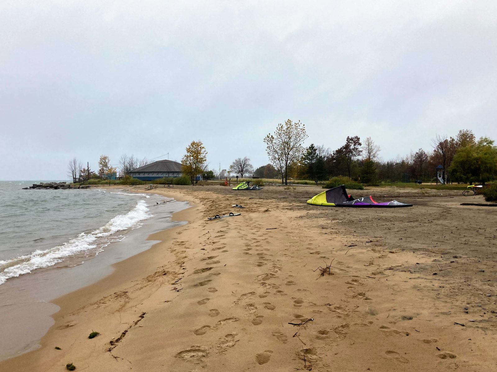
The Lake Huron side of the point on 22 October, with the day-use pavilion on the beach behind. Saginaw Bay Light was measuring an east wind at 14 knots gusting 19 at the minute this frame was taken — an easterly is cross-onshore on this beach and dead offshore across the bay, which is exactly why the session happened on this side of the sand.
Spot Guide
Where To Go In
The two park beaches sit back to back on the point, a few hundred yards apart and facing opposite ways. The two city beaches are on the bay's north and west shores, five and ten minutes away by car. Tap a pin for wind direction, skill level and parking.
The Launches
The Spots
Tawas Point State Park — day-use beach (Lake Huron side)
The one we have ridden, and the easiest beach here to turn up at cold. Follow the park signs for parking; the day-use area is a mile of sand on the Lake Huron flank of the point, with a pavilion, picnic tables, grills and a playground behind the beach, so there is somewhere to change and somewhere for everyone else to be. There is a designated, buoyed swimming area — stay off it and there is plenty of beach either side. Open lake in front means this side gets genuine chop when it blows, which is the appeal. Offshore on anything westerly.
Tawas Point State Park — bay side
The flat side, and where the school is based. Two things to know before you plan around it. First, the park's beach on this flank is the campground swimming beach — shallow, warm and full of families, which is not a place to be laying lines out. Second, that is exactly why the lesson operation exists: if you want the flat water, going through Motor City Kiteboarding, whose shop is on the bay at 542 Tawas Beach Road, is the path of least friction and the way to find out where riding is actually welcome. We have not ridden this side ourselves, so treat the shore angles above as geometry rather than as local gospel, and ask when you get there.
East Tawas city beach — the bay's north shore
Public beach and park on the town waterfront, facing south across Tawas Bay, and the obvious option if you are staying in town rather than at the park. Same flat bay water, approached from the other side — which also means the wind inverts: a southwesterly is side-onshore here and a westerly is offshore, the reverse of what the point's bay beach sees on the same day. It is a town beach, so expect swimmers in summer and pick your patch.
Tawas City park beach — the bay's west shore
The far corner of the bay, about ten minutes round the shore from East Tawas, facing east-southeast. It is the quiet option and it catches an easterly onshore — the same wind that is putting open-lake chop on the far side of the point is arriving here across three miles of shallow bay instead. Worth knowing about on a busy weekend.
Safety Intel
Hazards & Local Rules
- Piping plovers, and this one really matters. Great Lakes piping plovers have been federally endangered since 1985, and after nearly a decade's absence they came back to Tawas Point in 2023 — one nest and two fledged chicks, then two nests and seven chicks in 2024. Nesting areas are roped off and monitored right through the summer. A kite in the air reads to a nesting shorebird as a large predator, which is enough to push a parent off eggs; the standard guidance is to keep kites 200 yards clear. Kiteboarders have already been banned outright from beaches on Cape Cod over exactly this. Find the ropes before you pump up, and give them far more room than you think is polite.
- The bay's beach at the park is a campground swimming beach. Shallow, warm and designed for small children. It is the flattest water on the point and it is not a launch; go through the school or ask at the park office rather than assuming.
- Westerlies are offshore on the Lake Huron side. The day-use beach faces southeast, so anything from the west or northwest is blowing you out into open Lake Huron with the next land a long way downwind. That is the day to be on the other side of the point, not on this one with a bigger kite.
- Shallow and flat is not the same as small. The bay side is genuinely sheltered; the Lake Huron side of the same sandbar has the open lake in front of it and builds real chop on an east or northeast wind. They are a few hundred yards apart and they are not the same spot.
- Do not trust the weather station named after the point. NDBC TAWM4 sits right at the beach and reads about half the true wind — 13 knots when an exposed meter nearby is reading 25 to 30. If you are checking a live meter before driving, check one further away. This page uses Saginaw Bay Light #1 for exactly that reason.
- Winter is strong and mostly unusable. January through March hold as much rideable-direction wind as October does, and Tawas Bay is shallow enough to freeze in a normal winter. Shore ice is undercut and unstable — never walk out on it to launch.
- The point is a nature preserve as well as a beach. Marked trails, restricted dune and nesting areas, and a lighthouse with visitors around it. It is a busy little piece of land for something that looks empty from the water.
Gear by Season
What to Bring
Kite: 9m + 12m
Wing: 5m
Board: Twin-tip, or a foil for May
Suit: Early spring a 6/4 with gloves and boots; by late spring a 4/3. May is the bay's deadest month and the Huron side's northeast season — bring the foil.
Kite: 12m + 14m, and a foil or 17m for the light days
Wing: 5m + 6m
Board: Twin-tip on the bay, foil for the 9% days
Suit: 3/2, then a shorty, and often nothing at all by late summer — the shallow bay warms early.
Kite: 8m + 10m, 12m for the light end
Wing: 4m + 5m
Board: Twin-tip; a surfboard or foil for the Huron chop
Suit: The ladder runs back the other way — 3/2 early, 4/3 through the middle, 6/4 with gloves by late fall.
December is the second-windiest month of the year here at 31% of hours. It is also cold, and the bay ices as the season goes on. If you go: 6/4 hooded, gloves, boots, and kites a size down from what the forecast suggests, because cold air is dense.
Kite and wing sizes here are derived from the measured 17–22 knot band rather than from a logbook — they are a starting point, not local gospel. The wetsuit ladder is the one we actually use on this coast.
Local Knowledge
The Vibe
A cool little town. East Tawas is a proper Lake Huron resort town on Michigan's Sunrise Coast — a walkable main street a couple of blocks from the bay, a pier, a marina, and none of the pressure of the west-side tourist towns. It is a long way from anywhere, which is most of the charm.
The best place to stay if you are here to ride is Tawas Point State Park's campground, which puts you on the point with both beaches out the door. It books up in summer — the fall season the chart above points at is also when you can get a site.
For food and drink, the names that come up locally are Barnacle Bill's for breakfast, Boathouse Beer & Boozery for a beer after, Cozy Cup Coffee Company for the pre-dawn-patrol coffee, and Route 23 BBQ and Mangos Mexican Cuisine when you want a real meal. Those are researched rather than personally vouched for — treat them as a starting list, not a ranking.
Motor City Kiteboarding is the kite school on the bay, with a shop at 542 Tawas Beach Road and a lesson centre out at the point. If you are learning, or if you want to ride the flat side and are not sure where you are welcome, that is the door to knock on.
Rider FAQ
Frequently Asked Questions
When is the best time of year to kiteboard at East Tawas?
What wind direction is best at Tawas Point?
Is East Tawas a good place to learn to kiteboard?
Where do you launch at Tawas Point?
Why doesn't this page use the Tawas Point weather station?
What wetsuit do I need at East Tawas?
What about the piping plovers at Tawas Point?
SBLM4, the morning after, Sun 27 Sep
What last night's forecast was worth
Yesterday the Saginaw Bay Light #1 meter topped out at 12.1 kt at 6 am. The night before, NWS had 14 kt, the corrected NWS — what Premium is served — 14.2. The other 4 models ranged 12.5–14.7 kt.
How this was measured
One day is an illustration, not a record — a model that reads low every day will still land one. The number that means anything is the scored one over 90 days, in how our calls are graded.
Each model row is the highest wind it forecast for the 6am–6pm window at this meter, taken from the freshest run that existed before midnight the night before — between 10 and 23 hours ahead, depending on the hour. A model with no run in that window shows no call; it is never filled in from a closer-range forecast. Raw rows are the provider's own numbers; NWS + this meter's bias is that forecast shaded by this station's own measured error. That correction is Premium: a Premium rider is served the corrected row, and a free or signed-out rider is served the raw NWS row above it. The meter's figure is the strongest reading of each hour from this station's stored observations. Hours over your floor are counted from those readings alone; rideable is the nightly scorer's verdict and also weighs gust, direction and waves, so the two numbers are not the same measurement and are never added. Knots throughout.
Know Which Side Is On At Tawas
Two hundred and thirty-eight days a year carry a wind one side of this point can use. The hard part is knowing which side, and knowing early enough to make the drive. WindStoke watches the meters and the models and tells you.
Get Free Wind Alerts